

Geology Services
I turn faulted, complex reservoirs into consistent volumes and simulation-ready models that guide your next infill well.
Gulf of America specialist in salt-related box folds and complex salt-withdrawal minibasin stratigraphy, especially the Miocene. 17 years of industry geoscience (since 2009), much of it in the Gulf of America.
Four groups, twelve services
Each group is one page: its three services in a single scroll, with scope, deliverable, proof and figures.
01
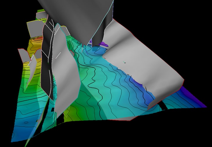
Structural Framework & Fault Modeling
Fault-honest structural frameworks you can drill against, update while drilling and hand straight to simulation.
Deliverable A QC’d structural framework and 3D grid, ready for property modeling.
3 services
1.1
Seismic-to-Model Fault Framework & Structure Mapping
Frameworks that are established and updatable, for well planning, geologic prognosis and real-time drilling updates.
Deliverable A QC’d structural framework and 3D grid ready for property modeling.
1.2
Fault Throw, Juxtaposition & Transmissibility
Know which sands talk across each fault before the simulator has to guess.
Deliverable Throw, juxtaposition and fault-property sets for every mapped fault.
1.3
Structural Scenario Geomodeling for Simulation Updates
The compartment geometry and fault seal your sim model is missing, before you pick the next infill well.
Deliverable Scenario frameworks and grids, each ready for simulation and history match.
02
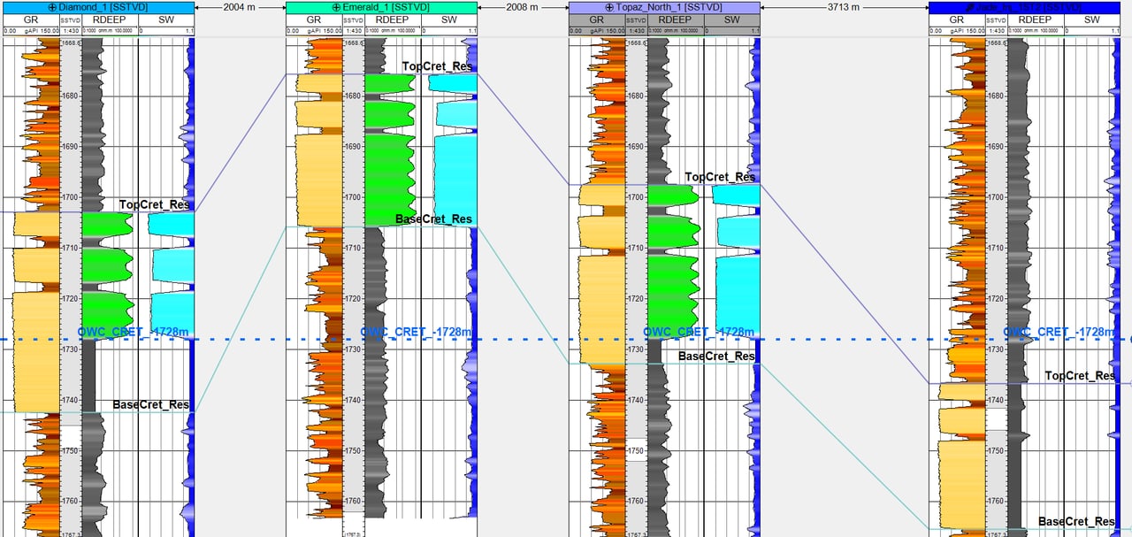
Well Correlation & Petrophysical Integration
Tops, logs, image logs and petrophysical zone averages reconciled into one QC’d database across every deviated well.
Deliverable A correlated tops database plus correlation panels.
3 services
2.1
Tops Picking, Fault Cuts & Correlation Panels
Consistent tops in every well, including the hard ones.
Deliverable A correlated, QC’d tops database plus correlation panels.
2.2
Stratigraphy: Image-Log, Log & Seismic Well-Top Harmonization
Tops that agree across image logs, logs and seismic. Combined with, and linked to, structural geomodeling.
Deliverable Harmonized well tops with facies and environment calls, mapped at the scale you need.
2.3
Well Pointsets: Zonal Thickness & Petrophysical Zone Averages
Spatial representation of well information is critical to mapping initiatives and modeling efforts.
Deliverable Maps plus spreadsheets, built to be easily maintained and updated as new wells are drilled.
03
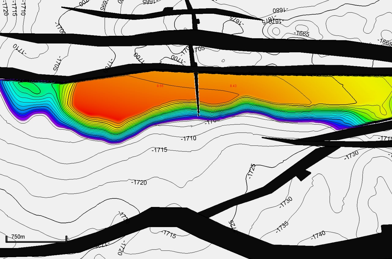
Mapping & Volumetrics
Thickness maps, zone averages and in-place volumes by fault block that survive peer review in structurally complicated fields.
Deliverable In-place and recoverable volumes by segment, with maps.
3 services
3.1
Bulk Rock Volume Assurance for Structurally Complicated Fields
Thickness that holds up across every fault, so your volumes do too.
Deliverable QC’d thickness pointsets and maps, and a BRV that is consistent across faults.
3.2
2D Map-Based Volumetrics: Independent Volumetric Assurance
A second set of expert eyes on your in-place numbers, before they go on the books.
Technical assurance, not a certified reserves audit.
Deliverable Independent STOIIP / GIIP with a clear audit trail of inputs.
3.3
Volume Ranges by Segment: P90 / P50 / P10
In-place and recoverable ranges, by fault block, that the whole team can read.
Deliverable In-place and recoverable volumes by segment, with maps and range charts.
04
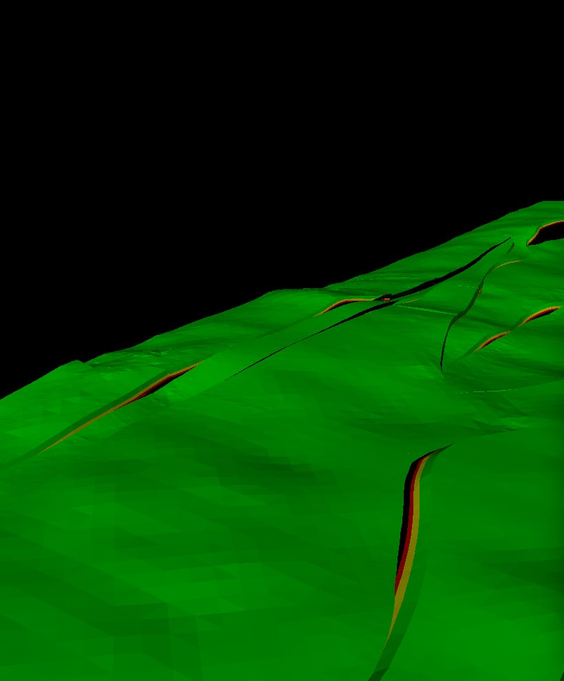
Development Well Planning & Reservoir Model QC
Well plans, regulatory volume inputs and model checks that hold up from prognosis to simulation.
Deliverable Well-planning volume inputs, Sw updates and a QC’d, handoff-ready grid for reservoir engineering.
3 services
4.1
Well Planning & WCD Volumetric Foundation
Well placement against faults and contacts, and a defensible Worst Case Discharge (WCD) volume basis for your BOEM plan, fast.
Deliverable Zone-by-zone WCD inputs and well-placement maps.
4.2
Seismic-Conditioned Reservoir Properties / Pseudo-4D
Geomodel properties conditioned to seismic response: where the oil still is, without shooting a 4D survey.
Deliverable Seismic-conditioned Sw and property models, seismic net pay maps, and remaining-HC maps and volumes.
4.3
Fault Transmissibility & Simulation Handoff
Faults built for the simulator: segmented ends, geologic realism, ready to history match.
Deliverable A QC’d fault model, TMULTs and grid, packaged for simulation and history match.
Tool strengths
Platform: Petrel (Master User, 2022 / Studio) and AspenTech RMS, plus 13 years of BP workflows
Seismic Interpretation
- Horizon and fault picking
- Seismic well tie
- Domain conversion
Structural Modeling
- Fault framework, structural framework
- Model construction, horizon clean-up
- Depospace, structural gridding
- QC Manager
Fault Analysis
- Throw, displacement, heave
- Juxtaposition
- Fault property editing
Well & Petrophysics
- Well correlation, tops QC
- LAS logs, image logs
- Petrophysical zone averaging
- Petrophysical modeling
Property & Facies Modeling
- Property population by zone
- Facies modeling
- Grid zonation and layering
Volumetrics
- Segments, contacts, volume
- STOIIP / GIIP, recoverable
- Deterministic and P90/P50/P10
Exploration Support
- Prospect generation and exploration support
- Exploration and appraisal characterization frameworks
- Mapping at subregional-to-local scales
AI & Workflow Automation
- Neurocraft AI (NeuroEarthIQ): automated lithology, depth and top picking
- AI-assisted interpretation; OSDU-aligned data strategies
How to engage
Start small, prove value on one block, then scale. Fast turnaround, remote, Houston-based.
30-minute fit call
We walk through your field, data and decision. You leave with a clear view of where the subsurface risk sits and whether I am the right fit.
Fixed-scope pilot
One fault block or one zone, fixed price and fixed scope. You see my framework, zone averages, maps and QC on your own data before committing further.
Full study
Field-wide framework, correlation, mapping and volumetrics, with handoff-ready grids for reservoir engineering.
Remote delivery · Houston, TX · Petrel and RMS on your license or mine
Mature Field Evaluation
Three offers, bundled for a mature field:
Bulk Rock Volume Assurance for Structurally Complicated Fields
Thickness that holds up across every fault, so your volumes do too.
Seismic-Conditioned Reservoir Properties / Pseudo-4D
Geomodel properties conditioned to seismic response: where the oil still is, without shooting a 4D survey.
Structural Scenario Geomodeling for Simulation Updates
The compartment geometry and fault seal your sim model is missing, before you pick the next infill well.


Field courses: coming
A paralic field trip in the Ferron Sandstone around Factory Butte, Utah, is in the works for September 2027.


Synthetic demonstration data: all datasets shown were built solely for demonstration purposes and are not client data.